

What is Paralino?
Paralino is a location sharing and family safety app for Android and iOS that encrypts location data end to end. Its README describes it as private, real-time location sharing with groups, travel tracking, place alerts and location history, and it adds a personal space for people who only want to track their own devices. The service is built and hosted in the European Union according to the official website, and the project states that it has no ads, no tracking and no data selling.
The mobile apps became open source in July 2026, as the announcement post explains, after development that the authors say began more than five years earlier as a personal project. The code is in a Kotlin Multiplatform repository: androidApp and iosApp modules, a shared library and several core-* modules, with most of the interface shared through Compose Multiplatform. The license is AGPL-3.0. The announcement covers the Android and iOS apps; it does not describe a server you can self-host, so this is an open-source client for a hosted service.
There are three ways to install it. The iOS app is on the App Store, the Android app with Google Maps is on Google Play, and a de-googled Android APK is published on the download page and as ParalinoAndroidDirect.apk in GitHub releases, with a documented apksigner check and a published signing certificate hash. The de-googled build avoids Google services: it uses MapLibre for maps, UnifiedPush or a direct WebSocket for push notifications and the AOSP location manager for location. The release reviewed here is v2.6.0, published on October 22, 2026, with separate Android and iOS tags; its notes point to the public changelog.
The project is not an offline tool and not a vehicle telematics platform. Sharing requires accounts on Paralino's service, and several limits depend on the plan. A free plan exists, with paid Mini, Pro and Max plans described on the plans page.
Paralino screenshots
Explore the interface. Open a screenshot to view it at full size.
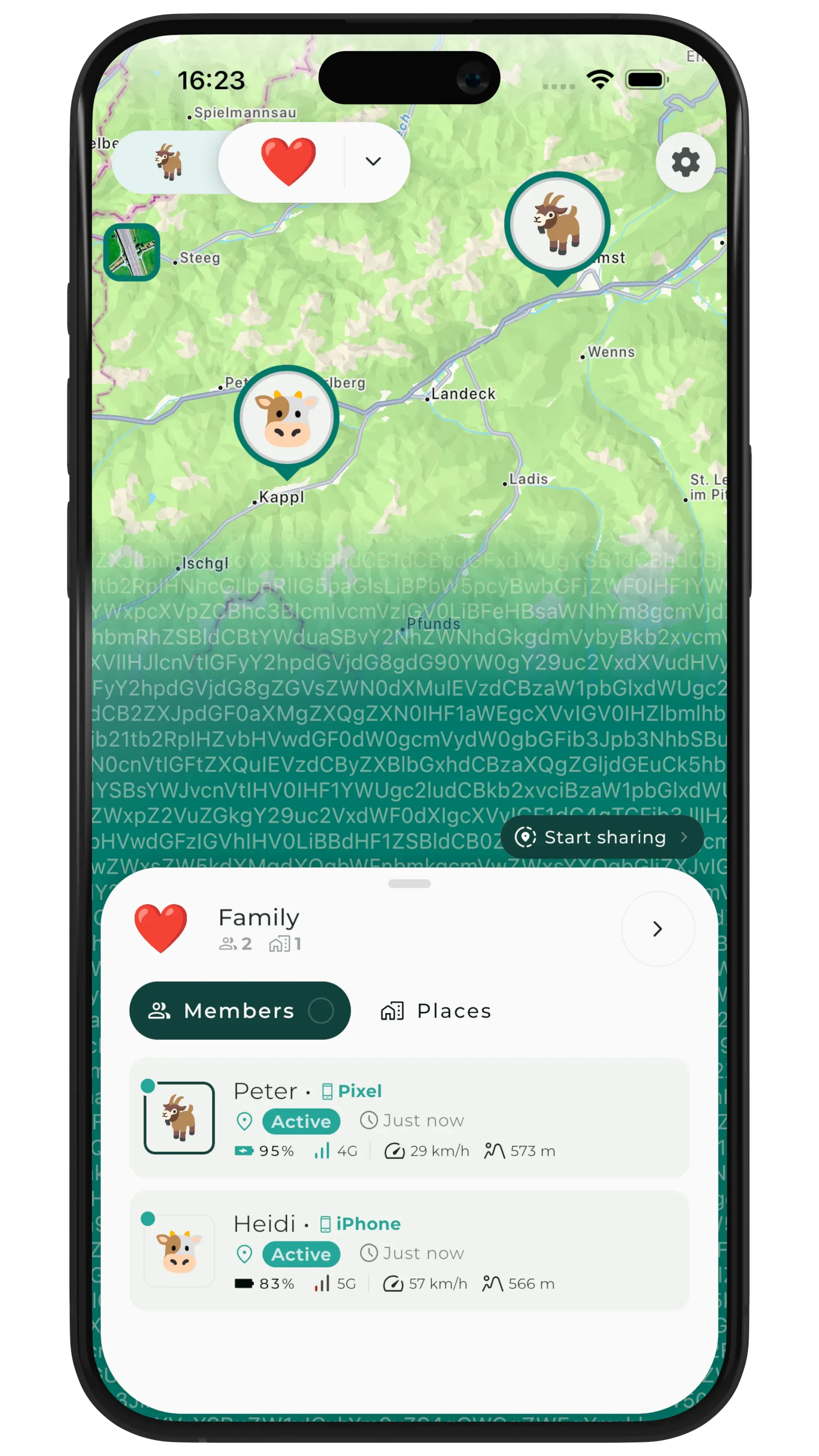
Official website screenshot: a map with two group members, using sample data and avatars.
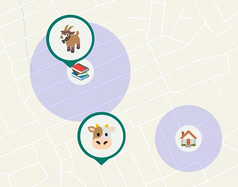
Official illustration of places with geofence circles and sample members.
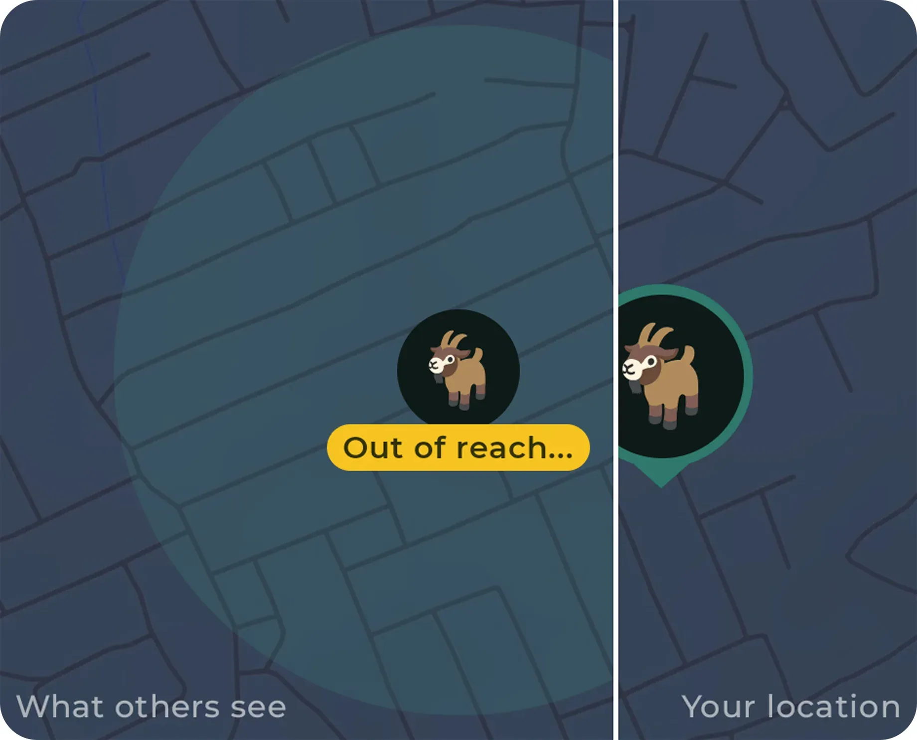
Official illustration of a privacy zone: others see an out-of-reach area, the owner sees the real position.
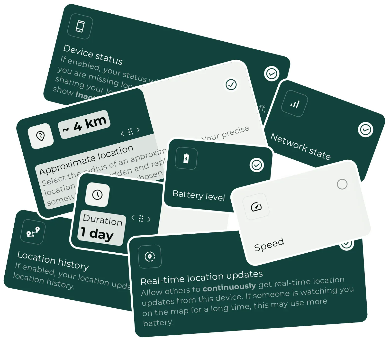
Official website graphic of sharing controls such as approximate location radius and duration.
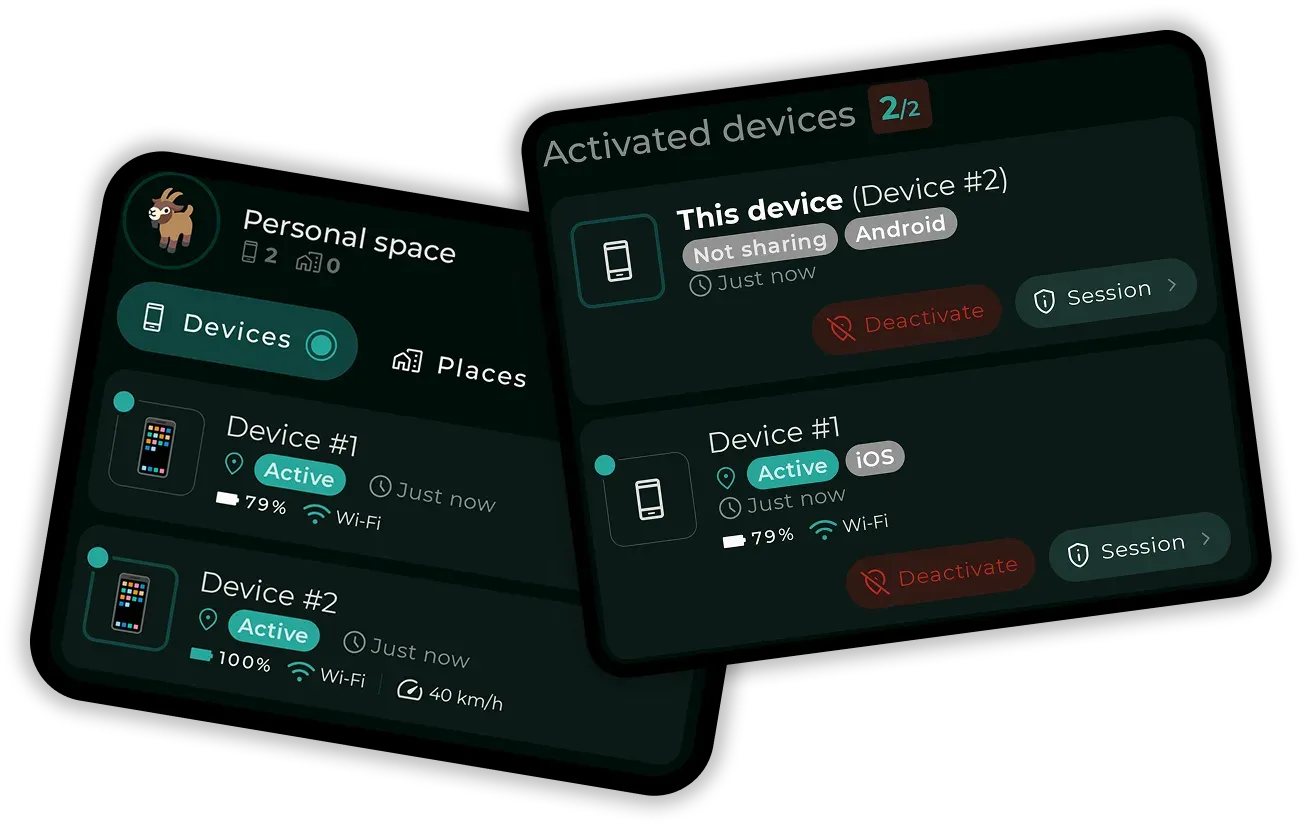
Official website graphic of the personal space and activated devices.
Source: official Paralino project page.
Key capabilities
- Real-time location sharing Members of a group see each other on a live map, with continuous updates while someone is watching and an option to request a location on demand. How the updates work, including battery cost, is explained in the help article on location updates. Free-plan updates are limited, and the paid plans list best location performance.
- Private groups Groups separate family, friends and trips, each with its own sharing settings. Plan limits apply: the free plan has 1 group and 2 members, Mini 1 group and 5 members, Pro 3 groups and 10 members, and Max 10 groups and 30 members. One paid plan covers the whole family, so only one person needs to subscribe.
- Granular sharing controls Per group, you choose what to share: exact or approximate location, speed, elevation, battery level, network state, device status and location history. Sharing can run for a set time such as ten minutes or one day, or indefinitely, and can be stopped at once. See the sharing data guide.
- Approximate location Instead of exact coordinates, a device can share a location blurred to a chosen radius, shown in the settings screenshots as about 4 km. This suits situations where a group needs to know a region, not a street. The setting is per device and group.
- Privacy zones A privacy zone is an area on the map where the app hides your actual position and switches to approximate sharing when you enter. The website shows a split view of what others see compared with your own location, with an out-of-reach marker. Zone counts depend on the plan, from 1 on Free to 100 on Max.
- Place alerts and geofences Places are map areas for home, work or school. Alerts fire when a group member enters or leaves, with separate enter and exit alerts per member, and the alerts are delivered as push notifications. The Free plan includes 2 places, Mini 5, Pro 10 and Max 100, all with unlimited alerts.
- Location history The app records trips with paths, stops and timing, and shows daily stats such as distance, time on the move, top speed and elevation. History retention depends on the plan: the free plan keeps at most 100 recent points for 2 days, while paid plans keep 10, 30 or 100 days and the personal space is unlimited on Max.
- Personal space A section only for you and your devices, used to find your own phones and tablets, review trips and keep a longer history that is shared with nobody. The screenshot shows activated devices with battery, connection and speed. Personal-space history is 10 days on Mini, 100 days on Pro and unlimited on Max.
- Device monitoring and low battery alerts Each device can report battery level, signal strength, speed, elevation and permission state on the map. Low battery alerts warn the group before a phone goes dark. Multiple devices, such as a phone and a tablet, can be linked to one account, with 1, 2 or 5 devices per member by plan.
- End-to-end encryption Locations, places, history and group data are encrypted on the device before upload. The architecture page describes libsodium for cryptography, Argon2id key derivation, master keys wrapped by a key encryption key, sender keys for locations and key rotation when members leave a group. Read it before relying on specific guarantees.
- Accounts and guest login Users can register with an email and password, which allows several devices, or use a guest account whose credentials are generated on the device and limited to one device. Guest accounts can be converted later according to the help center. Back up credentials, because the service says it does not hold your keys.
- De-googled Android edition The direct APK contains no Google services, uses MapLibre maps, UnifiedPush or WebSockets for push and has built-in updates so users need not download new versions by hand. Premium and satellite maps are listed as a paid feature on it. See the de-googled app guide.
- Battery and performance profiles You choose how hard the app works in the background: best battery, balanced or best performance, each setting how often the location updates. Test the profile on your own devices, because background location behavior differs by Android and iOS version and manufacturer.
- Rich push notifications Notifications cover someone joining a group, starting to share, low battery and entering a predefined place. On the de-googled build they arrive through UnifiedPush or WebSocket, which needs a distributor app or an open connection. iOS production features such as push and background location only work in approved production builds.
- Open-source build path Developers can build the Android app with Android Studio and the documented Gradle command, which produces a locally signed APK that matches the official de-googled build apart from the keystore. The iOS app needs Xcode 26.5 or newer. Clone the repository with submodules, as described in the README.
- Help center, roadmap and changelog The documentation lives in a searchable help center with articles on groups, places, privacy zones and permissions. A public roadmap and changelog are hosted on a feedback portal. Feature requests and bug reports go through GitHub issues and discussions.
Where Paralino fits
Keeping family members in sync
Create a group, invite members, then agree together what each person shares. Check on two real devices that the live map, battery level and last update time look right, and that everyone has granted background location permission. The group guide covers invitations and limits.
Setting arrival and departure alerts
Add places such as home and school, choose which members trigger alerts and walk through each boundary once to confirm timing. Remember that alert counts are limited by plan. Geofence accuracy depends on the phone's location settings, so check battery optimization on Android.
Sharing less precise information
Use approximate location or a privacy zone around your home or workplace, then compare what another group member sees against your own map. Choose a radius that matches your comfort level, and review it when you change address.
Tracking your own devices
Use the personal space with a phone and a tablet to locate them and review your own trips without sharing with anyone. Confirm how many days of history your plan keeps before depending on it, and export or note important trips yourself.
Using Android without Google services
Install the de-googled APK from the official download page, verify its signature with apksigner against the published certificate hash, and set up UnifiedPush if you want push without a persistent connection. Test push delivery after a reboot and with battery saver on.
Auditing the code and the cryptography
Read the architecture page, then review the repository's shared core modules for key handling and storage. Build the app locally with the documented command and compare behavior with the published APK. Treat the audit as a review of the client only, since the server is not part of the published repository. Note any dependency on external map tile providers and push services while you are there, because they see network metadata even when content is encrypted.
Reviews of Paralino
Be the first to share your experience with Paralino.
Write a review
Loading review form…
