

What is Organic Maps?
Organic Maps is a free, open-source offline map and GPS navigation app for Android and iOS, built on OpenStreetMap data. It is developed by an open community together with founders of the earlier MapsWithMe (MAPS.ME) app, and published by Organic Maps OÜ, a company registered in Tallinn, Estonia. Maps are downloaded per country or region; after that, search, routing, voice guidance, bookmarks and track recording work without a network connection. The project states that the app shows no ads, collects no location or usage data and needs no account. On November 3, 2026 the project reported more than 12 million installs.
The mobile app is distributed through the App Store, Google Play, Huawei AppGallery, F-Droid, Accrescent and Obtainium. Obtainium installs the APK attached to each GitHub release, which also lists a SHA-256 checksum. A Linux desktop beta is published on Flathub. The project describes the desktop app as mainly a development and testing tool without feature parity; Windows builds are compiled and staged in CI, but no Windows release is distributed.
The latest GitHub release, 2026.09.29-32-android, ships OpenStreetMap data as of September 28, 2026 and Wikipedia data as of September 21. It improves alternative routes and their arrival estimates, keeps the selected alternative when navigation recalculates, adds a setting that reorders intermediate stops, adds buttons to add or replace a stop, and fixes track recording and KMB imports. The June 2026 update introduced public transport routing by subway, light rail, bus and tram, a shortest-route alternative, an experimental satellite layer that needs a user-supplied tile server, and a new Android search and routing interface. August added multi-selection and per-track hiding for bookmarks and tracks. Each update is described in the project news.
The shared core is written in C++: the Drape rendering library, an offline routing engine, search and ranking, a map indexer, a built-in OpenStreetMap editor and the generator that builds compact .mwm region files. Android, iOS and a Qt desktop shell sit on top of that core, as the repository structure guide explains. Source code is licensed under Apache-2.0. Map and terrain files follow a separate binary data license that combines OpenStreetMap data under ODbL, Wikipedia text under CC BY-SA and several elevation datasets.
Development is funded mostly by the founders and by donations, with targeted support from the NLnet Foundation NGI0 Entrust fund for search and font work, Google Summer of Code student projects, and donated map-hosting capacity from Mythic Beasts and 44+ Technologies. A governing board described in GOVERNANCE.md oversees the roadmap and trademarks. The in-app editor handles points of interest only, and the app has no user accounts, reviews or business listings of its own.
Organic Maps screenshots
Explore the interface. Open a screenshot to view it at full size.
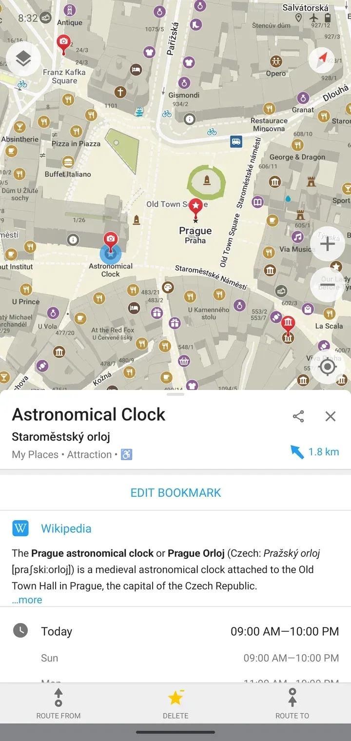
Official screenshot from organicmaps.app: a saved place in Prague with an offline Wikipedia extract and opening hours.
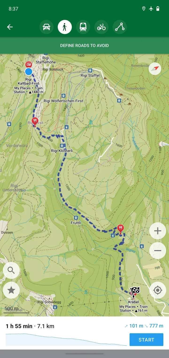
Official screenshot from organicmaps.app: a planned hiking route with contour lines, ascent and descent totals and an elevation chart.
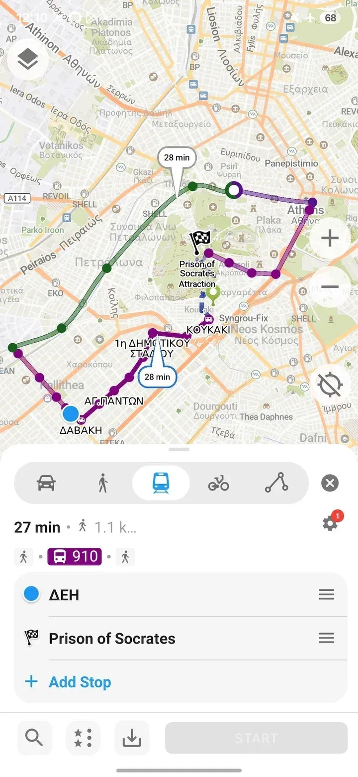
Official screenshot from the June 2026 release news showing public transport routing with a bus line and a planned stop list.
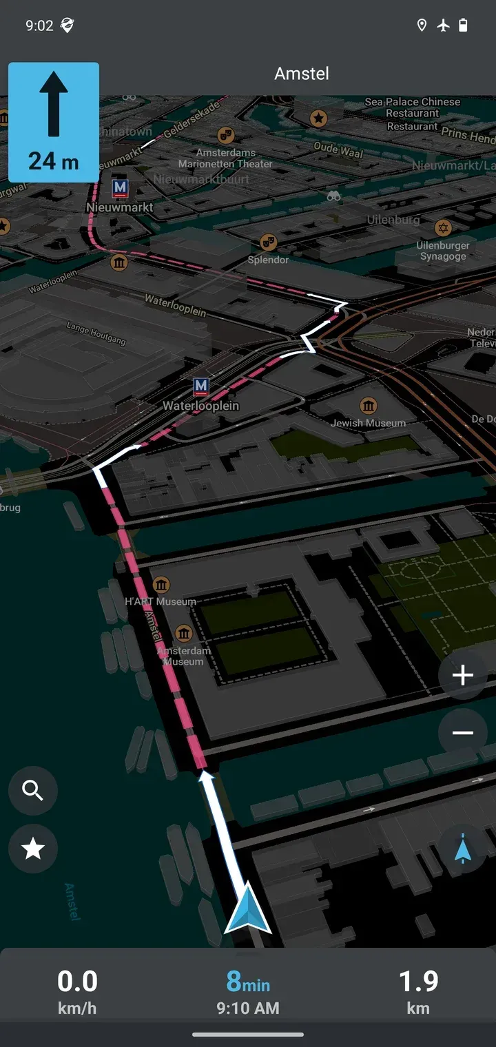
Official screenshot from organicmaps.app: driving guidance in dark mode with speed, time to arrival and remaining distance.
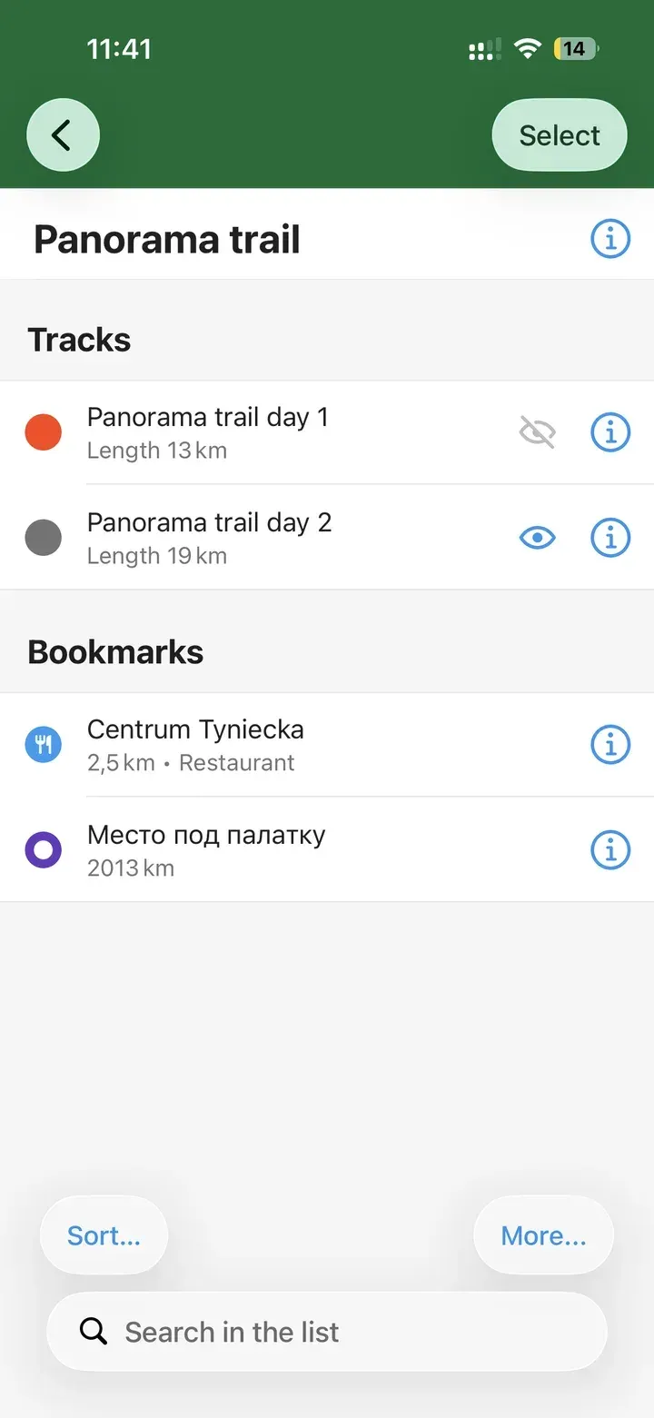
Official screenshot from the September 2026 release news showing the eye icon that hides individual tracks.
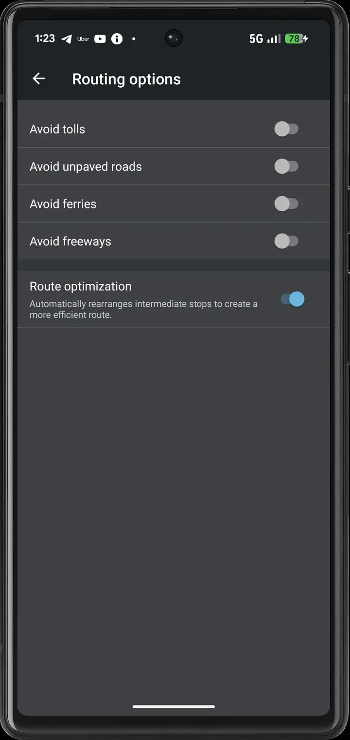
Official screenshot from the September 2026 release news showing the new route optimization setting for intermediate stops.
Source: official Organic Maps project page.
Key capabilities
- Download Organic Maps for Android Install from Google Play, F-Droid, Huawei AppGallery or Accrescent, or track GitHub releases with Obtainium; each release attaches a web-release APK and its SHA-256 checksum. The supported versions FAQ lists Android 5 or later and a GPU with OpenGL ES 3.0 or Vulkan. The app runs on devices with or without Google services. A beta channel is offered through Firebase App Distribution.
- Download Organic Maps for iPhone and iPad The iOS app is published on the App Store under the id 1567437057, and the FAQ lists iOS 12 or later. A public TestFlight beta receives features before store releases. CarPlay support and iOS Dynamic Type large fonts are part of the iOS app.
- Linux desktop beta Install the Flatpak with
flatpak install flathub app.organicmaps.desktop; Flathub lists a download of about 161 MiB, and distribution packages are tracked on Repology. The desktop app uses mouse and keyboard shortcuts, for example Shift-click to set route points and Alt plus right-click to add a bookmark. The project states that it has not reached feature parity with the mobile apps and is not optimized for Linux phones. - Offline vector maps by region Each country or region is a separate .mwm file, so only the areas you need take storage. Large countries are split into smaller regions; in May 2026 Vietnam, Malaysia and Tanzania were divided further. Map data is refreshed from OpenStreetMap with app updates, roughly monthly in 2026, and downloads are served from project servers.
- Offline search Search covers addresses, place names, categories and brands in the downloaded regions, without sending queries to a server. Recent releases added about two million US addresses, operator names for unnamed results such as ATMs, and a fix for searches across the 180 degree meridian. Plus Codes and coordinates can be opened through geo links.
- Car, walking and cycling navigation Turn-by-turn guidance with voice instructions works offline for driving, walking and cycling. Routing options avoid tolls, unpaved roads, ferries or freeways, and a fastest route can be compared with a shortest alternative. On Android, voice guidance requires an installed text-to-speech engine; the voice icon is disabled when none is available.
- Public transport and metro maps Since June 2026 the app routes by subway, light rail, bus and tram where OpenStreetMap contains the transit data. Tapping a stop and choosing a route number highlights the whole line. A separate subway layer shows metro networks for supported cities, so coverage depends on the city.
- Multi-stop route planning Routes can include intermediate stops, with buttons to add or replace a stop in a planned route. A setting added in September 2026 reorders intermediate stops for a shorter trip, and the stop order now survives an app restart. The selected alternative route is kept when navigation recalculates.
- Terrain for hiking and cycling Contour lines, peaks, slopes and elevation profiles support outdoor planning, and marked hiking and cycling routes are shown on the map. Walking and cycling routes warn about steps, gates and lift gates. Elevation charts appear for planned routes and tracks; terrain comes from SRTM, Copernicus and other datasets listed in the data license.
- Bookmarks and tracks Import and export KML, KMZ, KMB, GPX and GeoJSON files, as described in the import FAQ. GeoJSON tracks keep elevation and timestamps. Bookmarks accept any color, lists support multi-selection, and individual tracks can be hidden with an eye icon. Descriptions can contain simple HTML.
- Track recording Record a GPS track and save it as a track in a bookmark list; Android can stop and save a recording from its notification. Battery optimization on many Android devices can stop background recording, and the FAQ points to vendor-specific settings. Test a long recording before relying on it.
- Wikipedia and place details offline Popular places include Wikipedia extracts bundled with the map data, refreshed with each release; August 2026 added articles in Bengali, Hindi, Marathi, Polish, Tamil, Telugu and Urdu. Place pages show opening hours, websites and other details where they exist in OpenStreetMap.
- Built-in OpenStreetMap editor Signed in with an OpenStreetMap account, you can add a place or edit names, opening hours and other attributes. Edits are uploaded to OpenStreetMap and later appear in the map data for every user. The editor is limited to points of interest: roads, building outlines, lakes and moving existing places need a full OSM editor.
- Android Auto and CarPlay The app projects maps and guidance to car head units through Android Auto and CarPlay. The September 2026 release added maneuver instructions on the CarPlay dashboard and supported head-up displays. Requirements for Android Auto are linked from the FAQ.
- Coordinate systems and grids Besides latitude and longitude, the app displays British National Grid, Irish Grid and Irish Transverse Mercator coordinates, added in June 2026. The desktop app can switch the displayed coordinate system. This helps when trail guides or rescue services use national grids.
- Deep link API Other apps can open Organic Maps through om:// links and https://omaps.app URLs to show points, search, or build a route by car, foot, bicycle or transit. The v2 dir and nav endpoints accept multiple waypoints and callback URLs for each stop. geo: URIs and many Google Maps URLs are also handled; the API test page lists working examples and links the Android and iOS API code.
- Dark mode and map styles A dark style reduces glare at night, and recent releases raised the contrast of rivers and wetlands in dark mode. Area patterns distinguish beaches, sand, scree, bare rock, orchards and vineyards. Intermittent water now uses a dotted pattern.
- Experimental satellite imagery Satellite imagery can be enabled in settings with a custom raster tile server URL containing x, y and z placeholders. The project does not yet run its own imagery server, so you choose a third-party source. This is an online feature: tiles are requested from that server, outside the offline model.
- Build from source The build guide requires at least 4 GB of RAM, CMake 3.22.1, Python 3.11 and Qt 6 for the desktop app, with about 20 GB of free space; Android builds use Android Studio and about 30 GB. Ubuntu 24.04 or newer is fully supported, and native Windows builds compile in CI with MSVC. The repository also contains the map generator used to build .mwm files from OpenStreetMap extracts.
Where Organic Maps fits
Preparing a trip without mobile data
Download every region along the route on Wi-Fi before leaving, including neighbouring regions near borders, and check free storage on the phone. Then switch to airplane mode and test an address search, a route and voice guidance. If a download fails, the download FAQ suggests another network or deleting and redownloading very old maps. Update maps after app updates so routing and search use the same data release.
Planning a multi-day hike or bike tour
Import the planned route as GPX or KML into its own bookmark list, then compare it with contour lines and the elevation profile. Use walking or cycling routing to fill gaps between waypoints and watch for warnings about steps and gates. Before relying on track recording, disable battery optimization for the app on Android and record a short test with the screen off. Export tracks after the trip, because bookmarks are stored locally on the device.
Getting around a city by public transport
Choose the transit mode to route by subway, light rail, bus and tram, and open the subway layer for metro diagrams. Transit routes come from OpenStreetMap, so check one known journey in the target city before depending on it. Timetables and live departures are not part of the documented feature set; treat the result as a route and line guide.
Driving with Android Auto or CarPlay
Set routing options such as avoiding tolls, ferries or unpaved roads before starting, and confirm that a text-to-speech voice is installed on Android. Add stops in order or enable route optimization to let the app reorder them. Test the head unit connection while parked, and use the Android Auto FAQ for compatibility requirements.
Fixing a missing place on the map
Sign in with an OpenStreetMap account in the app settings, open a place and choose edit, or add a new place with a category, name and opening hours. Edits go to OpenStreetMap, so they are public and appear in Organic Maps after a later map data refresh. For roads, paths or building outlines, use a full OSM editor as the advanced editing FAQ explains.
Sending routes from another app
Dispatch or delivery tools can open the app with a v2 dir or nav link that carries an origin, a destination, several waypoints and callback URLs. Build links from the examples on the API test page and confirm the callbacks on both Android and iOS. Because routing runs on the device, the receiving phone must already have the regions downloaded.
Install
flatpak install flathub app.organicmaps.desktopReviews of Organic Maps
Be the first to share your experience with Organic Maps.
Write a review
Loading review form…
Related to Organic Maps
 NewPipeNewPipe is a libre, lightweight Android streaming front-end for YouTube, PeerTube, Bandcamp, SoundCloud and media.ccc.de that needs no account.
 God's Eye ViewGod's Eye View combines public aircraft, satellite, earthquake and camera feeds in a Cesium globe. Run it locally, inspect each data source, add optional voice control and connect agents through MCP.